| |
Xinjiang
( 2005-09-13 )
 Geography Geography
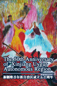
 Xinjiangwas set up as an autonomous region in Northwest China on October 1, 1955. It has an area of more than 1.66 million square kilometers, one-sixth of the total size of China and larger than any other province or autonomous region. Xinjiangwas set up as an autonomous region in Northwest China on October 1, 1955. It has an area of more than 1.66 million square kilometers, one-sixth of the total size of China and larger than any other province or autonomous region.
 Climate Climate
Situated deep in the interior of Asia and not penetrated by the air currents from the oceans, the Xinjiang Uygur Autonomous Region has a conspicuous continental climate, with a highly changeable temperature, great difference in temperature between day and night, abundant sunshine, intense evaporation, and little precipitation.
The mean annual temperature of Xinjiang is 11.7 degree Celsius -- the hottest month, July, averaging about 25 degree Celsius and the coldest month, January, -20 degree Celsius in the north and -10 degree Celsius in the south -- and a mean annual precipitation of 150 mm.
Administrative Division and Population
It is divided into 2 prefecture-level cities, 5 districts, 5 autonomous prefectures, 14 county-level cities, 61 counties, and 6 autonomous counties with a population of 19.25 million by 2000, of which 5 million are Uygurs, the principal minority group there; the rest are the Hans, Kazaks, Mongolians, Huis, Xibes, Kirgizes, Ozbeks, Tajiks, Russians, Manchus, Daurs, and Tatars.
 Food Food
Famed food include Baked Full Goat, Baked Baozi, Pellicle Baozi, Kebab, Braised Jemmy and Goat's Hoof, Youtazi (Oil Pagoda), and so on.
 Culture Culture
This includes Uygur dances such as the "Bowls-on-Head," "Drum," "Iron Ring," "Puta," and "Sainaim" dances and Uygurmusical instruments, such as the Dutar (tw0-stringed lute), the strummed Rawap (6-stringed guitar), and the Dap (a percussion).
|
|

